


Length: 63 Miles
Driving Time: 4 to 6 Hours
The Alpine Loop is not for the faint of heart! Requiring four-wheel drive for most of it’s 67 rugged miles, those up for the challenge will be rewarded! Passing through old mines and 7 ghost towns, hillsides of wildflowers, 2 high alpine passes and roads established in the early 1800’s, the Alpine Loop is one of the most exciting journeys in Colorado. You can enter the Alpine Loop in Silverton, Ouray or Lake City. The road ascends to Animas Forks, a historic mining town that met it’s decline in the 1920s. At 11,200 feet, Animas Forks was one of Colorado’s highest settlements. Above Animas Forks, the loop splits and you can either descend down Mineral Creek to US 550 and Ouray or go to new heights on Cinnamon Pass (12,640 ft) and Engineer Pass (12,800 ft) which lead back into Lake City. Along the route, you can expect to see many abandoned settlements, mining towns and pristine Colorado Mountains!
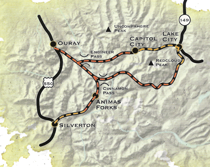
Photos, Map and Information adapted from CDOT.