

The Sandstones, The City of Gnomes, White-Shrouded Ghosts, Dante’s Lost Souls, Phantom Ships…
These are many of the epithets applied to the jumbled mass of pinnacles and domes hidden deep within the mountains at Wheeler Geologic Area. High in the La Garita range of Rio Grande National Forest, Wheeler is 640 acres of haunting landscape. If you are visiting the town of Creede and looking for a long day hike or an even longer day behind the wheel of your 4WD, Wheeler is the place to head.
History
This is the vicinity to which John Charles Fremont led his expedition of 36 men in the winter of 1848. Anxious to demonstrate that the railroad could plow through the Colorado Rockies even in the dead of winter, Fremont proved instead that even men and mules might not make their way.
In 1907, Frank Spencer began hearing rumors of a special place hidden in the La Garita Mountains. “The Ute Indians call it ‘the Sandstones’,” reported the sheepherders that frequented the mountain pastures. Spencer, supervisor of the Rio Grande National Forest, had been instructed to identify areas that might be worthy of national monument status and the Sandstones sounded like they might qualify. In the middle of the year, Spencer selected a route up Bellows Creek. After a long and tiresome day, his party found their reward. In Spencer’s words:
“A truly remarkable site…before us, enhanced by the rays of the setting sun, lay the vista of what seemed to us an enchanted city. Spires and domes, castles and cathedrals, mosques and temples, with their fluted columns and wonderfully carved friezes, were arrayed in a confusing panorama of form and color.”
Following this trip, Spencer filed a recommendation that Wheeler be designated a national monument, and when he traveled to Washington shortly thereafter, he pushed for action. Gifford Pinchot, Chief of the Forest Service, took up the cause. On December 7, 1908, President Theodore Roosevelt proclaimed Wheeler National Monument, named in honor of Captain George Wheeler who led the War Department’s surveying team through Colorado in 1874. Later it was returned to the National Forest Service oversight in 1950 as Wheeler Geologic Area.
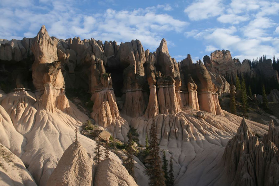
Geology
Wheeler is an excellent example of a landscape that passes through a very interesting history. It is now at its prime and has developed a maximum of fantastic features. The rock in this area is a moderately coarse volcanic tuff. The debris that formed this tuff was blown into the air from volcanic vents and settled at this place. Individual particles of this debris may range in size from dust flakes to blocks two or three feet across. They have not been cemented together or firmly compacted. Therefore, the beds crumble readily from the erosive forces of rain and wind.
As the rains have fallen upon this easily eroded material, the water has carried away much of the finer debris. Larger blocks have remained as capstones for sharp spires or pinnacles, which stand alone when the surrounding unprotected material has been washed away. Slight differences in texture or in the amount of compaction result in the development of the different shapes and forms. Also, vertical joint cracks weaken the beds at intervals and these can form what appear to be hooded ghosts.
In the future, the existing spires and pinnacles will crumble away, and ultimately this area will be reduced to one of the softened contours characteristic of old, worn-down mountains.
Hiking and Backpacking
The hike to Wheeler makes for a long 16-mile round-trip. At the end of the day, you may be beat but you will have passed through beautiful sub-alpine terrain and large open parks to a remarkable geologic formation that rivals Bryce Canyon.
To reach the trailhead, drive about 7 miles southeast of Creede on Colorado 149, then turn right on Pool Table Road, #600 and proceed about 10 miles to Hanson’s Mill. The two-wheel-drive road ends here. The trail heads north, starting about 10,800 feet and rising to almost 12,000 at the formations. It drops to East Bellows Creek in 2 miles, then climbs through the spruce forests of Silver Park. In another 4 to 5 miles, you will hit a four-wheel-drive road. About a mile farther, enter the world of the Sandstones! (4WD vehicles must stop about half a mile before the formations.)
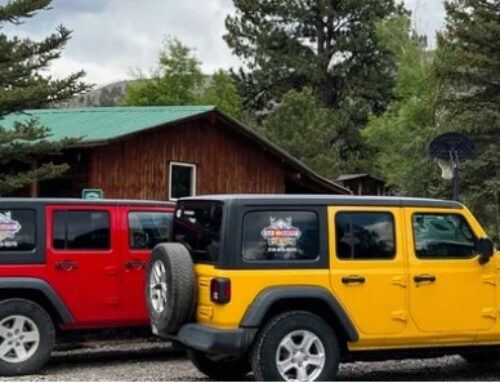
Four-Wheeling to Wheeler
The 4WD road to Wheeler also leaves from Hanson’s Mill. It travels almost 14 miles, not quite twice the hike. But it is likely to take longer than walking. Expect close to 8 hours of driving time and plan 10 to allow for some exploring.
The road is slow-going over a rough, roundabout and rutted route. Take advantage of that to enjoy the spectacular scenery. Near its end, it is narrow and twisting through the trees. In the slippery ruts, maneuvering is a challenge. The road is impassable when wet and closed to vehicles in the spring. It typically opens in mid to late June and as early as Memorial Day in an exceptionally dry year.
From Hanson’s Mill, the four-wheel-drive road is well-signed and marked with white arrows. All four-wheel-drive travel is restricted to the marked roads only, with the exception that you may drive off the road for up to 300 feet to gain access to suitable undeveloped campsites along the route. You should stop by any Forest Service Office and obtain a Travel Map if you have questions concerning travel restrictions.
The road climbs from Hanson’s Mill through spruce/fir for 0.4 mile to a road junction. The left fork is not the four-wheel-drive route to Wheeler but can be driven for a little over 1 mile where it dead-ends just before East Bellows Creek. From this point, the route continues as a trail (foot, horse, and trailbike only) for 5.7 miles to the Wheeler Geologic Area. This trail is part of the old Alder Creek Stock Driveway, which today is Trail #790. There is limited parking for 3 to 4 vehicles at the end of this spur road. If you prefer hiking, and are in good physical condition, you can probably walk to Wheeler faster than driving a four-wheel-drive vehicle the 14 miles to Wheeler via the jeep road. If you plan to drive into Wheeler, however, go straight at the road junction rather than following this left fork of the road. From this junction, the Pool Table Road #600 travels northeast, gently climbing 360 feet in elevation over the next 3.9 miles. The first 3 miles of this section of road continue through spruce/fir and then break into the open to follow the treeline on the right until the road swings northwest and crosses East Bellows Creek.
From this point to within 1.5 miles of its end, the road traverses primarily through open sub-alpine country. Just up the hill from the East Bellows Creek crossing, the road turns northwest and is relatively level for the next 2.6 miles, except where the road crosses Trujillo Creek and the Canyon Fernandez drainage. From the Canyon Fernandez drainage, the road drops about 540 feet over the next 2.5 miles to the Canyon Nieve drainage. This portion of road swings from a southwest direction to northwest. The road then continues to the west, climbs 460 feet over the next 1.2 miles, and then levels out for approximately 1.6 miles to where Trail #790 joins the road.
The next mile of road/trail drops 360 feet in elevation through spruce/fir trees. This section is narrow and twists its way through the trees. The lower part of this section (which is only about 3/4 mile from the end of the road) is often muddy and rutted, making maneuverability difficult because of the tight squeeze through the trees. The slippery rutted conditions usually force vehicle wheels to follow the existing ruts. This section requires some driving skills to successfully negotiate when wet. Larger vehicles have an even more difficult time through this section.
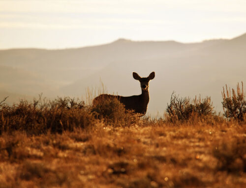
The final half-mile of road breaks back into a small park and dead-ends at the fence, marking the end of the road and the boundary of the Geologic Area. This is as far as motor vehicles are allowed. From this point a foot and/or horse trail continues approximately 0.6 mile on to the formations. Even though the trip is rough and slow, the subalpine scenery and presence of wildlife are beautiful and more than makes up for the trip.