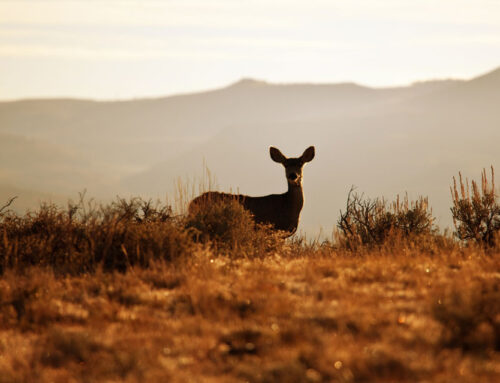


Rio Grande County has about 300+ miles of mountain biking & hiking trails, From BLM’s, USFS and Park trails, we have a wide variety of terrain from open parks, meadows and hills to climb from 7800 ft to 12,000 ft. These trails follow designated trails and roads and as always leave no trace behind, just footprints or tracks. Many of these trails are multi use for horseback, hike and bike as well as some could cross paths with motorized vehicle roads. Be courteous and share the trail with others and ALWAYS consult weather conditions, never go alone, make sure family members, friends or lodge owners know your location. There is no shortage of summer fun here.
Hiking group Silver Thread Outdoor Club 719.873.5512. The club sponsor group hikes throughout the season and love newcomers and visitors to the area to join them. Please contact them to make sure the group is meeting. General Schedule is every Monday & Wednesday morning at the South Fork Visitors Center Parking Area before 9 am. Mid April – Late September.
Mountain Bike & E-Bike Rentals
..
Trail Information

#879 Middle Frisco Creek Trail
Intermediate/Advanced – Elevation: 9000 ft – 11,500 ft
The USFS’s Middle Frisco Trail is a classic 6.3 mile, one-way, mountain bike ride or hike, climbing from 9,000 feet to 11,500 feet and ending at Frisco Lake. The trail follows Middle San Francisco Creek through beautiful aspen groves for the first few miles. It then climbs through a mix of open meadows and spruce/fir forest, with 10 switchbacks on the upper section of the trail that are rideable with a nice grade. There are only a few hike-a-bike sections on the trail. Once you arrive at Frisco Lake, take some relaxing time before returning on the same trail. Watch out for hikers and horses on the way down. The downhill ride is fun! It is a great ride for intermediate and advanced riders. Read more here.
Driving Directions: From the Town of Del Norte on Colorado Highway 160 turn south on French Street (aka County Road 13) for 10 miles until you dead end at the dual trailheads. The Middle Frisco Trailhead is at the first parking lot just as you cross the cattle guard.

Del Norte Parks Trail & Lookout Mountain Park Trails System
Beginner/Intermediate Elevation: Summit 8,475 ft
Del Norte’s Lookout Mountain is a USGS named summit at 8,475 feet. It is part of the Town of Del Norte’s 200-acre Lookout Mountain Park Trails System. The recreational park and entire trails system, to date, comprises almost eight miles of natural surface, single track trails providing diverse experiences to hikers, runners, bicyclists, and equestrians. The more difficult one-mile trail to the summit has an elevation gain of 600 feet with wonderful craggy switchbacks near the top. Its breathtaking summit view displays the entire San Luis Valley and the upper Rio Grande corridor. The land and trails system connect the town to the Del Norte High School on the east, to the BLM land on the south, and to the Rio Grande Hospital and Medical Center on the west. Read More.
Trail Map Link
Driving Map below is to the Summit Trailhead on 11th & Columbia.

BLM Pronghorn Trails System
Intermediate/Advanced Elevation 7,884 to 8,600 feet
The BLM’s Pronghorn Trails System, totaling 9.5 miles of purpose-built single track trails, was constructed in the summer of 2016. The non-motorized natural surface trails are rated intermediate to advanced for mountain bikers. Located between County Rd. 13 and County Rd. 14, Pronghorn is south of Del Norte and connects to Del Norte’s Lookout Mountain Park and Trails. See Map Here The trail area is situated at elevations of 7,884 to 8,600 feet, and is open from May 1 to December 31. Read More
Driving Directions: This trail is 1 ½ miles south of Del Norte, CO on Rio Grande County Road 13 (aka French Street). It is easily accessed off of US Highway 160; turn south onto French Street in Del Norte, which becomes County Road 13. The Pronghorn north trail head parking and information kiosks are across from the Del Norte Cemetery.
Photo by Raleigh Burt & Trail Information Courtesy of DelNorteTrails.org & MTBProject.com
Rio Grande County has about 300+ miles of mountain biking & hiking trails, From BLM’s, USFS and Park trails, we have a wide variety of terrain from open parks, meadows and hills to climb from 7800 ft to 12,000 ft. These trails follow designated trails and roads and as always leave no trace behind, just footprints or tracks. Many of these trails are multi use for horseback, hike and bike as well as some could cross paths with motorized vehicle roads. Be courteous and share the trail with others and ALWAYS consult weather conditions, never go alone, make sure family members, friends or lodge owners know your location. There is no shortage of summer fun here.
Hiking group Silver Thread Outdoor Club 719.873.5512. The club sponsor group hikes throughout the season and love newcomers and visitors to the area to join them. Please contact them to make sure the group is meeting. General Schedule is every Monday & Wednesday morning at the South Fork Visitors Center Parking Area before 9 am. Mid April – Late September.
Trail Information
#879 Middle Frisco Creek Trail
Intermediate/Advanced – Elevation: 9000 ft – 11,500 ft
The USFS’s Middle Frisco Trail is a classic 6.3 mile, one-way, mountain bike ride or hike, climbing from 9,000 feet to 11,500 feet and ending at Frisco Lake. The trail follows Middle San Francisco Creek through beautiful aspen groves for the first few miles. It then climbs through a mix of open meadows and spruce/fir forest, with 10 switchbacks on the upper section of the trail that are rideable with a nice grade. There are only a few hike-a-bike sections on the trail. Once you arrive at Frisco Lake, take some relaxing time before returning on the same trail. Watch out for hikers and horses on the way down. The downhill ride is fun! It is a great ride for intermediate and advanced riders. Read more here.
Driving Directions: From the Town of Del Norte on Colorado Highway 160 turn south on French Street (aka County Road 13) for 10 miles until you dead end at the dual trailheads. The Middle Frisco Trailhead is at the first parking lot just as you cross the cattle guard.
Del Norte Parks Trail & Lookout Mountain Park Trails System
Beginner/Intermediate Elevation: Summit 8,475 ft
Del Norte’s Lookout Mountain is a USGS named summit at 8,475 feet. It is part of the Town of Del Norte’s 200-acre Lookout Mountain Park Trails System. The recreational park and entire trails system, to date, comprises almost eight miles of natural surface, single track trails providing diverse experiences to hikers, runners, bicyclists, and equestrians. The more difficult one-mile trail to the summit has an elevation gain of 600 feet with wonderful craggy switchbacks near the top. Its breathtaking summit view displays the entire San Luis Valley and the upper Rio Grande corridor. The land and trails system connect the town to the Del Norte High School on the east, to the BLM land on the south, and to the Rio Grande Hospital and Medical Center on the west. Read More.
Trail Map Link
Driving Map below is to the Summit Trailhead on 11th & Columbia.
BLM Pronghorn Trails System
Intermediate/Advanced Elevation 7,884 to 8,600 feet
The BLM’s Pronghorn Trails System, totaling 9.5 miles of purpose-built single track trails, was constructed in the summer of 2016. The non-motorized natural surface trails are rated intermediate to advanced for mountain bikers. Located between County Rd. 13 and County Rd. 14, Pronghorn is south of Del Norte and connects to Del Norte’s Lookout Mountain Park and Trails. See Map Here The trail area is situated at elevations of 7,884 to 8,600 feet, and is open from May 1 to December 31. Read More
Driving Directions: This trail is 1 ½ miles south of Del Norte, CO on Rio Grande County Road 13 (aka French Street). It is easily accessed off of US Highway 160; turn south onto French Street in Del Norte, which becomes County Road 13. The Pronghorn north trail head parking and information kiosks are across from the Del Norte Cemetery.
Photo by Raleigh Burt & Trail Information Courtesy of DelNorteTrails.org & MTBProject.com

Stone Quarry Trail System
The BLM’s Stone Quarry Trails area is a venue for mountain bikers and hikers alike at elevations from 7,900 to 8,100 feet. It is located between Monte Vista and Del Norte, just off of US highway 160 to the south; the entrance being less than five miles east of Del Norte and ten miles west of Monte Vista. See Map Here
To date there are 7.4 miles of purpose built slick rock and natural surface trail. This is a unique, rugged region with large boulder formations which give the user a sense of seclusion. Map and more info courtesy of DelNorteTrails.org See area map See Stone Quarry on MTBProject.com for more info. Photos courtesy of MTBProject. Parking areas off Hwy 160. Rio Grande Sportsmen’s Club Gun Range Road (map below).
Limekiln Trail System
The Limekiln is 13,783 acres of BLM land that connects via 24.1 miles of motorized single track and 29.2 miles of open roads to a multitude of canyons and 9.3 miles of single track Monument, just a few miles east of the Stone Quarry entrance. Map and Info courtesy of DelNorteTrails.org See area map
See Limekiln Trail Tour on MTBProject.com for more info. Photos courtesy of MTBProject.
Parking area off Hwy 160. the Old Spanish Trail San Luis Valley. Map Below

Big Meadows Reservoir Trail – #FS 410
Big Meadows Reservoir is a multi-use trail area that surrounds the lake. Used by hikers, fishermen and bikers during the season. Park at either side of the reservoir area and the trail is readily marked. Enjoy an easy to moderate 2 miles hike/bike around the stunning views of the lake. Some rocky incline areas mixed with forest, wildflowers, meadows and bridges. A family fun day combined with fishing or a picnic.
Stone Quarry Trail System
The BLM’s Stone Quarry Trails area is a venue for mountain bikers and hikers alike at elevations from 7,900 to 8,100 feet. It is located between Monte Vista and Del Norte, just off of US highway 160 to the south; the entrance being less than five miles east of Del Norte and ten miles west of Monte Vista. See Map Here
To date there are 7.4 miles of purpose built slick rock and natural surface trail. This is a unique, rugged region with large boulder formations which give the user a sense of seclusion. Map and more info courtesy of DelNorteTrails.org See area map See Stone Quarry on MTBProject.com for more info. Photos courtesy of MTBProject. Parking areas off Hwy 160. Rio Grande Sportsmen’s Club Gun Range Road (map below).

Limekiln Trail System
The Limekiln is 13,783 acres of BLM land that connects via 24.1 miles of motorized single track and 29.2 miles of open roads to a multitude of canyons and 9.3 miles of single track Monument, just a few miles east of the Stone Quarry entrance. Map and Info courtesy of DelNorteTrails.org See area map
See Limekiln Trail Tour on MTBProject.com for more info. Photos courtesy of MTBProject.
Parking area off Hwy 160. the Old Spanish Trail San Luis Valley. Map Below
Big Meadows Reservoir Trail – #FS 410
Big Meadows Reservoir is a multi-use trail area that surrounds the lake. Used by hikers, fishermen and bikers during the season. Park at either side of the reservoir area and the trail is readily marked. Enjoy an easy to moderate 2 miles hike/bike around the stunning views of the lake. Some rocky incline areas mixed with forest, wildflowers, meadows and bridges. A family fun day combined with fishing or a picnic.

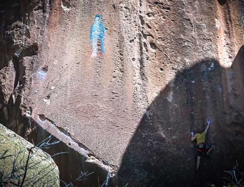
Bishop’s Rock Area
The BLM’s Bishop Rock Area is in the hills just south of Monte Vista at an elevation of 8,280 feet, and is unmatched anywhere in the State of Colorado. See Map Here It contains a 40 acre slick-rock non-motorized open play area for bikers and hikers. For advanced riders, this freeform area of flowing rocks creates something similar to a natural skate park. This playground, designated as such by the BLM, has all the features you could ever want to test your skill level.
Info courtesy of DelNorteTrails.org and more info and photos courtesy of MTBProject.com
In Monte Vista, at the corner of US Highway 160 an Colorado State Highway 15 (aka Broadway), turn south and drive for 2.5 miles to Rio Grande County Road 28 and drive for 7.7 miles; turn right into the Bishop Rock Parking area; at this point are the No Motorized Vehicles signs; off load and ride on down the two track to the “domed rock area.”

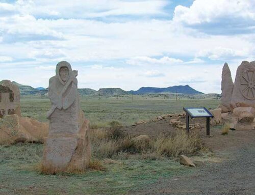
Penitente Canyon Recreation Area
The BLM’s Penitente Canyon Special Recreation Management Area has 19 trails for mountain bikers and hikers to enjoy among twisty rock canyons and towering boulders. A recently reworked trail system offers 21 miles of rides for all levels, from easy pedals to technical boulder jumping. These trails provide high alpine riding as well as some of the best features of desert canyon. One of the trails is named “Rock Drops” for very obvious reasons.
Enjoy. 61 Miles of Trail, 2 Recommended Routes, 11 Easy Trails , 9 Intermediate Trails , 1 Difficult Trail
Info courtesy of DelNorteTrails.org Trail Map and more trail user info and photos from MTBProject.com

Trout Creek Trail #831
Intermediate/Difficult – The trail begins with a 1.0 mile climb, followed by a 1.0 mile descent, another 1.0 mile climb, and another 1.0 mile descent before a steady climb up the drainage on an old road. Designed for motorcycles, there are several switchbacks in the first 4.0 miles that are wide enough for good practice on these.
User Contributed Trail info and photo courtesy or MTBProject.com
Bishop’s Rock Area
The BLM’s Bishop Rock Area is in the hills just south of Monte Vista at an elevation of 8,280 feet, and is unmatched anywhere in the State of Colorado. See Map Here It contains a 40 acre slick-rock non-motorized open play area for bikers and hikers. For advanced riders, this freeform area of flowing rocks creates something similar to a natural skate park. This playground, designated as such by the BLM, has all the features you could ever want to test your skill level.
Info courtesy of DelNorteTrails.org and more info and photos courtesy of MTBProject.com
In Monte Vista, at the corner of US Highway 160 an Colorado State Highway 15 (aka Broadway), turn south and drive for 2.5 miles to Rio Grande County Road 28 and drive for 7.7 miles; turn right into the Bishop Rock Parking area; at this point are the No Motorized Vehicles signs; off load and ride on down the two track to the “domed rock area.”
Penitente Canyon Recreation Area
The BLM’s Penitente Canyon Special Recreation Management Area has 19 trails for mountain bikers and hikers to enjoy among twisty rock canyons and towering boulders. A recently reworked trail system offers 21 miles of rides for all levels, from easy pedals to technical boulder jumping. These trails provide high alpine riding as well as some of the best features of desert canyon. One of the trails is named “Rock Drops” for very obvious reasons.
Enjoy. 61 Miles of Trail, 2 Recommended Routes, 11 Easy Trails , 9 Intermediate Trails , 1 Difficult Trail
Info courtesy of DelNorteTrails.org Trail Map and more trail user info and photos from MTBProject.com
Trout Creek Trail #831
Intermediate/Difficult – The trail begins with a 1.0 mile climb, followed by a 1.0 mile descent, another 1.0 mile climb, and another 1.0 mile descent before a steady climb up the drainage on an old road. Designed for motorcycles, there are several switchbacks in the first 4.0 miles that are wide enough for good practice on these.
User Contributed Trail info and photo courtesy or MTBProject.com