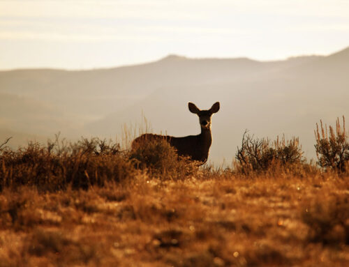


Know Before you go. Trails listed are multi use trails. Please be courteous to other and use common sense while on the trail. Slow down around others and pass with care if you are in a motorized vehicle and as always practice stay on the trail guidelines to minimize damage to trails and forests. visit StaytheTrail.org
You can download trail maps free on the Colorado Trail Explorer app (COTREX) in the Android or Apple Play Store or visit the website at https://trails.colorado.gov
Colorado OHV Regulations & Registration go to Colorado State Parks & Wildlife Page


Trails Near South Fork Co
| No. | Name | Miles Long |
Elevation | Difficulty | Uses |
|---|---|---|---|---|---|
| 799 | Alder Bench Trail | 1.5 | 8400 – 8900 | Difficult | |
| 839 | Archuleta Trail | 7.0 | 9200 – 12200 | Moderate | |
| 709 | Bear Creek Trail | 4.6 | 9200 – 10800 | Difficult | |
| 933 | Beaver Mountain Trail | 3.7 | 8200 – 9200 | Easy | |
| N/A | Big Meadows Loop Trail | 1.5 | 9220 – 9250 | Easy | |
| N/A | Big Park Trail | 11.0 | 10400 – 12000 | N/A | |
| N/A | Bonito Pass Trail | 0.5 | 11000 – 11300 | N/A | |
| 794 | Cathedral Trail | 3.7 | 9400 – 11200 | Easy – Difficult | |
| 935 | Church Creek Trail | 1.0 | 8400 – 9000 | Moderate | |
| 812 | Cross Creek Trail | 4.7 | 8400 – 9000 | Moderate | |
| 834 | Decker Trail | 4.5 | 10000 – 11500 | Mod – Difficult | |
| 810 | East Trout Trail | 7.0 | 9500 – 12000 | Moderate | |
| 832 | Elk Creek Trail | 4.6 | 8800 – 11000 | N/A | |
| 832 | Highline Trail | 9.5 | 10500 – 12600 | Moderate | |
| 838 | Hope Creek Trail | 6.1 | 9500 – 12000 | Moderate | |
| 800 | Hunters Lake Trail | 1.1 | 11400 – 11600 | Moderate | |
| 837 | Kitty Creek Trail | 4.7 | 9900 – 12600 | Moderate | |
| 836 | Lake Fork Trail | 3.7 | 8800 – 11000 | Easy | |
| 847 | Main Beaver Trail | 2.3 | 11000 – 11400 | N/A | |
| 797 | Middle Alder Trail | 5.0 | 8800 – 11200 | N/A | |
| 761 | Palisade Trail | 2.1 | 8400 – 9500 | Moderate | |
| 830 | Raspberry Trail | 4.9 | 8800 – 11800 | Difficult | |
| N/A | Sawtooth Trail | 2.8 | 11200 – 12000 | N/A | |
| 837 – 846 | Shaw Lake Loop Trail | 1.1 | 9900 | N/A | |
| 750 | South Fork Archuleta Trail | 3.6 | 10400 – 11400 | Mod – Difficult | |
| 710 | Spruce Lakes Trail | 0.5 | 11200 – 11300 | Easy | |
| 842 | Tewksberry Trail | 6.1 | 8400 – 10200 | Moderate | |
| 835 | Tie Hill Trail | 8.0 | 9500 – 11500 | Mod – Difficult | |
| 831 | Trout Trail | 10.4 | 8400 – 11000 | Mod – Difficult | |
| 798 | West Alder Trail | 6.0 | 10000 – 11200 | Easy – Difficult | |
| 932 | West Bear Trail | 4.2 | 8800 – 11000 | Difficult | |
| 849 | Wolf Creek Trail | 8.7 | 8600 – 12000 | N/A |
Bicycles and any motorized vehicle is NOT ALLOWED in any Wilderness Area
All information and links from http://www.fs.usda.gov/
Trail Guide Near Del Norte, CO
| No. | Name | Miles Long |
Elevation | Difficulty | Uses |
|---|---|---|---|---|---|
| 786 | Benino Trail | 5.2 | 10200 – 11800 | N/A | |
| 872 | Bennet Creek Trail | 7.0 | 9500 – 12000 | Difficult | |
| 873 | Burro Trail | 7.1 | 9500 – 11000 | Mod – Difficult | |
| 786 | Castle Rock Trail | 3.6 | 9000 – 10600 | N/A | |
| 786 | Deadman Loop Trail | 4.6 | 8300 – 8700 | N/A | |
| 700 | Dry Creek Trail | 16.0 | 9000 – 12100 | Mod – Difficult | |
| 786 | East Frisco Trail | 1.8 | 9200 – 10200 | N/A | |
| 792 | Embargo Creek Trail | 5.9 | 8500 – 12500 | Moderate | |
| 786 | Fremont’s Camp Trail | 3.5 | 9600 – 11800 | N/A | |
| 894 | Frisco-Fitton Trail | 3.6 | 10800 – 12800 | Difficult | |
| 795 | Groundhog Trail | 6.3 | 10800 – 11900 | N/A | |
| 786 | La Garita Creek Trail | 11.3 | 8800 – 11200 | Difficult | |
| 787 | La Garita Stock Driveway Trail | 91.9 | 8600 – 12900 | Easy – Moderate | |
| 879 | Middle Frisco Trail | 6.3 | 9000 – 11500 | Mod – Difficult | |
| 796 | Perry Creek Trail | 8.2 | 10500 – 12200 | N/A | |
| 786 | Schrader Creek Trail | 4.7 | 9800 – 11000 | Difficult | |
| 898 | Shady Creek Trail | 11.4 | 9400 – 11200 | Moderate | |
| 850 | West Frisco Trail | 7.6 | 9600 – 13200 | Difficult |
Bicycles and any motorized vehicle is NOT ALLOWED in any Wilderness Area
All information and links from http://www.fs.usda.gov/
Trail Guide Near Monte Vista CO
| No. | Name | Miles Long |
Elevation | Difficulty | Uses |
|---|---|---|---|---|---|
| 701 | North Rock Creek Trail | 7.6 | 9000 – 11700 | Easy – Moderate | |
| 702 | South Rock Creek Trail | 1.9 | 11000 – 12000 | Easy – Moderate |
Bicycles and any motorized vehicle is NOT ALLOWED in any Wilderness Area
All information and links from Rio Grande National Forest